Road 8k
Banana Path, Ainsworth, Daisyfield & Woos Nab
Distance
9.1 km
Elevation
+83m
Terrain
Road
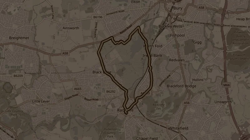
A loop north of the market with a steady climb out and a long run home. Blackburn Street and Whittaker Street lead onto the Banana Path, which climbs gently towards Ainsworth Road; Higher Ainsworth Road and Grindsbrook Road take you to the high point, about 50 metres up over the first 3.2k. A short stretch of Bury and Bolton Road leads to Starling Way and Farm Crescent, then the Bolton-Bury Cycleway starts the descent. Woos Nab Lane, half a kilometre of gravel track, drops you onto Hinds Lane and Warth Fold Road, and Bury Road, Eton Hill Road and Cross Lane bring you back into town via Church Street West. Mostly road, with about a third on paved cycle paths and the one short gravel lane.
This is one of the free running routes used by Run Together Radcliffe, a free running club meeting every Thursday at 7pm at Radcliffe Market. Everyone is welcome.